


HARLEM 1 Voting District, Stephenson County, Illinois
About
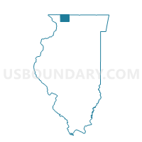
Outline

Summary
| Unique Area Identifier | 574782 |
| Name | HARLEM 1 Voting District |
| County | Stephenson County |
| State | Illinois |
| Area (square miles) | 27.32 |
| Land Area (square miles) | 27.28 |
| Water Area (square miles) | 0.04 |
| % of Land Area | 99.84 |
| % of Water Area | 0.16 |
| Latitude of the Internal Point | 42.33381730 |
| Longtitude of the Internal Point | -89.70129000 |
Maps


Graphs
Select a template below for downloading or customizing gragh for HARLEM 1 Voting District, Stephenson County, Illinois


Neighbors
Neighoring Voting District (by Name) Neighboring Voting District on the Map
- BUCKEYE 2 Voting District, Stephenson County, IL
- ERIN Voting District, Stephenson County, IL
- FLORENCE 1 Voting District, Stephenson County, IL
- FREEPORT 14 Voting District, Stephenson County, IL
- FREEPORT 15 Voting District, Stephenson County, IL
- FREEPORT 16 Voting District, Stephenson County, IL
- FREEPORT 17 Voting District, Stephenson County, IL
- FREEPORT 18 Voting District, Stephenson County, IL
- FREEPORT 19 Voting District, Stephenson County, IL
- FREEPORT 20 Voting District, Stephenson County, IL
- FREEPORT 21 Voting District, Stephenson County, IL
- HARLEM 2 Voting District, Stephenson County, IL
- LORAN Voting District, Stephenson County, IL
- WADDAMS Voting District, Stephenson County, IL
Top 10 Neighboring County Subdivision (by Population) Neighboring County Subdivision on the Map
- Freeport township, Stephenson County, IL (25,638)
- Harlem township, Stephenson County, IL (2,275)
- Loran township, Stephenson County, IL (1,442)
- Buckeye township, Stephenson County, IL (1,359)
- Florence township, Stephenson County, IL (1,293)
- Waddams township, Stephenson County, IL (807)
- Erin township, Stephenson County, IL (410)
Top 10 Neighboring Place (by Population) Neighboring Place on the Map
Top 10 Neighboring Unified School District (by Population) Neighboring Unified School District on the Map
- Freeport School District 145, IL (30,679)
- Lena-Winslow Community Unit School District 202, IL (5,301)
- Pearl City Community Unit School District 200, IL (2,690)
- Orangeville Community Unit School District 203, IL (2,488)
Top 10 Neighboring State Legislative District Lower Chamber (by Population) Neighboring State Legislative District Lower Chamber on the Map
Top 10 Neighboring State Legislative District Upper Chamber (by Population) Neighboring State Legislative District Upper Chamber on the Map
Top 10 Neighboring 111th Congressional District (by Population) Neighboring 111th Congressional District on the Map
Top 10 Neighboring Census Tract (by Population) Neighboring Census Tract on the Map
- Census Tract 9, Stephenson County, IL (5,307)
- Census Tract 10, Stephenson County, IL (4,437)
- Census Tract 8, Stephenson County, IL (3,436)
- Census Tract 2, Stephenson County, IL (3,409)
- Census Tract 5, Stephenson County, IL (3,149)
- Census Tract 4, Stephenson County, IL (3,008)